

The Science Behind Weather and Natural Disasters
Weather can change from calm sunshine to heavy rain, powerful winds, or dangerous thunderstorms within hours. Natural disasters can transform entire communities even faster. Although these events sometimes appear unpredictable, they are driven by physical processes that scientists can observe, measure, model, and increasingly forecast with sophisticated technology.
The science behind weather and natural disasters combines meteorology, climatology, geology, oceanography, hydrology, physics, and Earth science. Atmospheric pressure and temperature help create storms, while movement deep within Earth generates earthquakes and volcanic activity. Oceans, rivers, landscapes, and climate patterns further influence where hazards develop and how destructive they become.
It is also important to understand the difference between a natural hazard and a disaster. A hurricane over an uninhabited section of ocean is a powerful natural hazard, but it becomes a disaster when it significantly harms people, infrastructure, ecosystems, or economies. Population density, building quality, warning systems, and preparedness therefore influence the consequences as much as the physical event itself.
Learning how these systems work helps explain why some regions experience hurricanes while others face earthquakes, why floods sometimes develop within minutes, and why scientists can predict certain hazards more accurately than others. It also reveals how forecasting, engineering, emergency planning, and climate science can reduce risks even when nature itself cannot be controlled.
What Creates Weather on Earth?
Weather develops because Earth receives energy unevenly from the Sun. Areas near the equator generally receive more direct solar energy than polar regions, while land and oceans warm and cool at different rates. These temperature differences create changes in atmospheric pressure that set air in motion and help drive global weather patterns.
Warm air generally becomes less dense and rises, while cooler air tends to sink. As air moves between areas of different pressure, wind develops. Earth’s rotation then changes the direction of large-scale air movement through the Coriolis effect, helping create prevailing winds, jet streams, and rotating storm systems.
Water is another essential ingredient. Heat causes water to evaporate from oceans, lakes, soil, and vegetation, adding moisture to the atmosphere. When moist air rises and cools, water vapor can condense into tiny droplets or ice crystals, forming clouds and eventually producing rain, snow, hail, or other precipitation.
Weather is therefore the visible result of continuously interacting energy, air, and water. Small changes in temperature, humidity, pressure, and wind can produce very different outcomes, which is one reason forecasting becomes increasingly uncertain as scientists try to predict conditions farther into the future.
Why Weather Can Change So Quickly
The atmosphere is a dynamic fluid that constantly moves and exchanges energy. Air masses with different temperatures and moisture levels travel across continents and oceans, and when they meet, the boundary between them is called a front. Many rapid weather changes occur when one of these fronts passes through an area.
A cold front forms when colder, denser air pushes underneath warmer air and forces it upward. The rising warm air cools quickly, potentially creating clouds, thunderstorms, strong winds, and sudden temperature drops. Warm fronts usually create gentler uplift and can produce longer periods of widespread cloudiness or rain.
Changes in atmospheric pressure also signal shifting weather. Falling pressure often accompanies developing or approaching storm systems because rising air reduces pressure near the surface. High-pressure systems are more commonly associated with sinking air, which can limit cloud formation and produce clearer conditions.
Local geography adds another layer. Mountains can force moist air upward and increase rainfall on one side while producing drier conditions on the other. Coastlines generate sea breezes, cities create heat islands, and valleys can trap cold air or fog, making weather highly sensitive to location.
How Thunderstorms Form
Thunderstorms require three main ingredients: moisture, unstable air, and a mechanism that lifts warm air upward. When warm, humid air rises, it expands and cools. Water vapor then condenses into cloud droplets, releasing heat that can help the air continue rising and build a towering cumulonimbus cloud.
Within the storm, powerful updrafts and downdrafts move water droplets, ice crystals, and hailstones through different parts of the cloud. Collisions among these particles contribute to electrical charge separation, eventually creating the enormous voltage differences responsible for lightning.
Lightning heats the surrounding air extremely rapidly. That sudden heating causes the air to expand explosively, producing a pressure wave that we hear as thunder. Because light travels much faster than sound, lightning is seen before thunder reaches the observer.
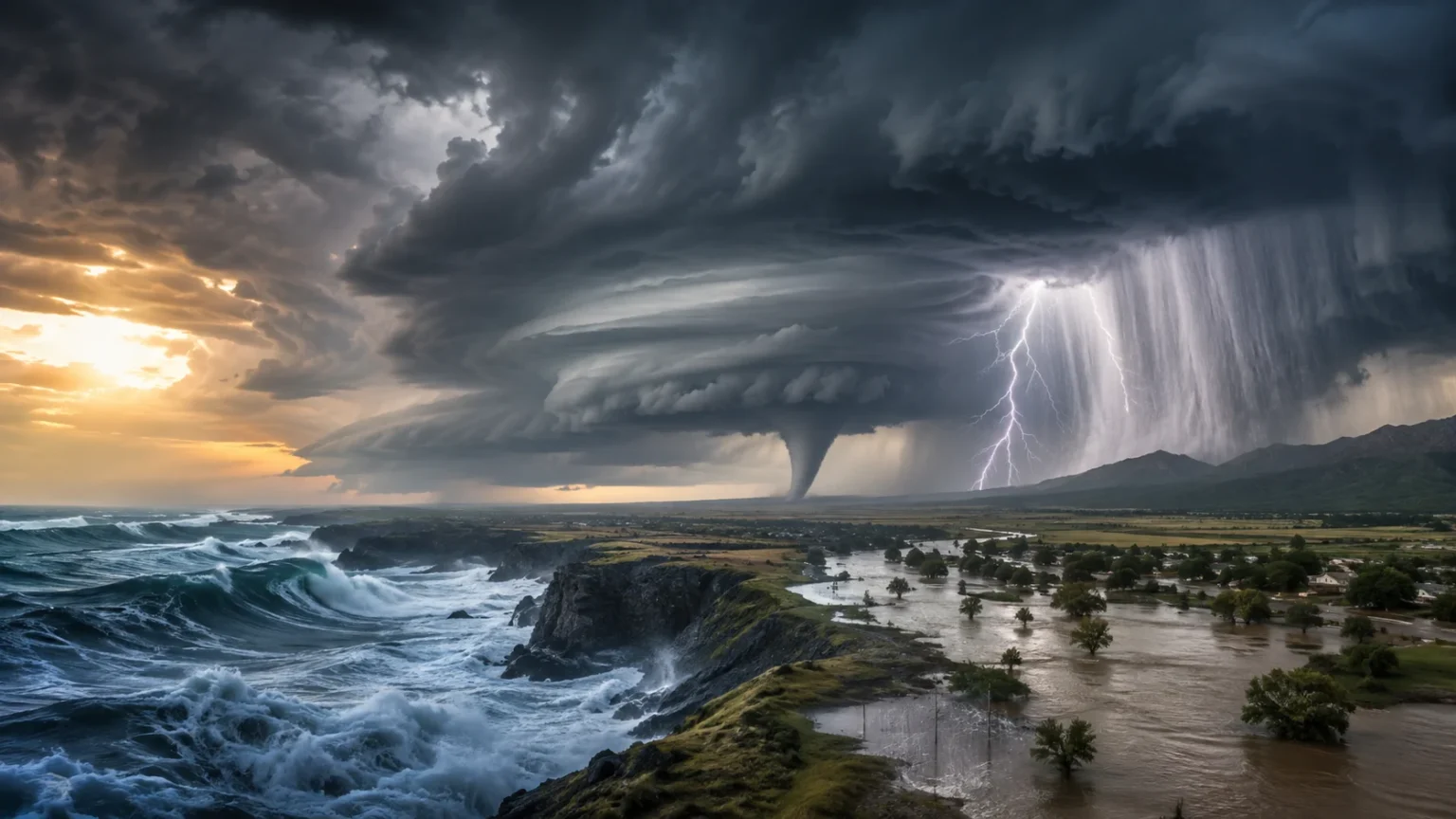
Severe thunderstorms can produce more than lightning. Strong downdrafts may create damaging straight-line winds, while intense rainfall can cause flash flooding. Hail and tornadoes may also develop when the storm environment contains the necessary combination of instability, wind shear, and rotating air.
How Tornadoes Develop
A tornado is a violently rotating column of air extending from a thunderstorm toward the ground. The strongest tornadoes are commonly associated with supercell thunderstorms, which contain a persistent rotating updraft known as a mesocyclone.
Wind shear plays a major role in creating this rotation. When wind speed or direction changes with altitude, air can begin rotating horizontally. A strong thunderstorm updraft can tilt that rotating air into a more vertical orientation and intensify the circulation.
Not every rotating thunderstorm produces a tornado. The exact transition from a mesocyclone to a fully developed tornado involves complicated interactions among temperature, moisture, pressure, downdrafts, and near-surface winds. This complexity is one reason tornado forecasting focuses heavily on identifying favorable environments rather than predicting the exact path hours in advance.
Meteorologists use Doppler radar to detect rotation within thunderstorms and issue warnings when a tornado is observed or strongly indicated. Radar, satellites, weather balloons, surface observations, and numerical models together help forecasters determine when atmospheric conditions are becoming favorable for severe storms.
How Hurricanes and Tropical Cyclones Form
Hurricanes, typhoons, and tropical cyclones are different regional names for similar powerful rotating storm systems. They develop over sufficiently warm tropical or subtropical ocean water when atmospheric conditions allow organized thunderstorms to grow around an area of low pressure.
Warm seawater provides energy through evaporation. Moist air rises within thunderstorms and releases heat as water vapor condenses, helping lower pressure and intensify the storm. More air then flows toward the low-pressure center, creating a cycle that can strengthen the system.
Earth’s rotation helps the incoming air curve, producing the characteristic spiral structure. Tropical cyclones generally need to form far enough from the equator for the Coriolis effect to provide sufficient rotation. Low vertical wind shear is also important because strong shear can tear the storm’s vertical structure apart.
Mature hurricanes may contain an eye surrounded by the eyewall, where some of the strongest winds and rainfall occur. Their hazards include destructive wind, extreme rainfall, flooding, large waves, and storm surge, which can push seawater far inland and cause catastrophic coastal damage.
Why Floods Happen
Flooding occurs when water covers land that is normally dry. The causes vary widely, including prolonged rainfall, intense thunderstorms, overflowing rivers, tropical cyclones, rapid snowmelt, dam failures, and coastal storm surge.
River flooding often develops when rainfall or melting snow adds water faster than the river channel can carry it downstream. Saturated soil can make the problem worse because less water can soak into the ground, sending more runoff directly into streams and rivers.
Flash floods develop much more quickly. Intense rainfall over steep terrain, dry hard ground, or urban surfaces can create rapidly moving water within minutes or hours. Roads, concrete, and buildings reduce infiltration and can concentrate runoff into drainage systems and low-lying areas.
Flood risk therefore depends on more than rainfall totals. Soil moisture, topography, vegetation, urban development, drainage infrastructure, river conditions, and the speed of precipitation all determine whether a particular storm becomes a minor inconvenience or a major disaster.
What Causes Drought?
Drought develops when an area receives substantially less water than expected over an extended period. It can begin with a shortage of rainfall or snowfall but may become more severe when high temperatures increase evaporation from soils, rivers, lakes, and vegetation.
Meteorologists distinguish between several types of drought. Meteorological drought refers to unusually low precipitation, agricultural drought involves inadequate soil moisture for crops, and hydrological drought occurs when rivers, reservoirs, or groundwater fall below typical levels.
Drought can build slowly, making it different from sudden disasters such as earthquakes or tornadoes. Its effects may accumulate over months or years, affecting crops, livestock, drinking-water supplies, hydropower, ecosystems, and wildfire risk.
Large-scale climate patterns can influence where drought develops. Changes in ocean temperatures and atmospheric circulation, including patterns such as El Niño and La Niña, can shift storm tracks and rainfall distribution across large areas of the world.
Why Heat Waves Become Dangerous
A heat wave is a prolonged period of unusually hot weather relative to normal conditions for a region. It often develops beneath persistent high-pressure systems that suppress clouds and rainfall while allowing strong sunlight to heat the land repeatedly.
High humidity can make extreme heat particularly dangerous because sweat evaporates less efficiently. Since evaporation is one of the body’s main cooling mechanisms, humid conditions can make the apparent temperature feel much higher and increase the risk of heat-related illness.
Cities may experience additional warming through the urban heat island effect. Asphalt, concrete, roofs, and other built surfaces absorb and store heat during the day, then release it slowly at night. Limited vegetation can further reduce cooling from shade and evaporation.
Heat waves can affect far more than personal comfort. They can increase electricity demand, damage crops, worsen drought, contribute to wildfire conditions, strain transportation infrastructure, and create serious health risks for vulnerable populations.
How Wildfires Start and Spread
Wildfires require fuel, oxygen, and a source of ignition. Lightning can naturally ignite vegetation, while human activities such as unattended fires, equipment sparks, power lines, or deliberate burning can also start fires.
Weather strongly determines how quickly a fire spreads. Hot temperatures and low humidity dry vegetation, making it easier to ignite. Strong winds provide oxygen, push flames toward new fuel, and carry burning embers far ahead of the main fire.
Terrain matters as well. Fire often moves more quickly uphill because rising heat preheats vegetation above the flames. Dry grasses may burn rapidly, while dense forests can provide larger quantities of fuel and produce more intense fire behavior.
Wildfire is a natural ecological process in many landscapes, but dangerous wildfire disasters occur when intense fires intersect with communities. Land management, building design, evacuation planning, drought, climate conditions, and development near fire-prone vegetation all influence the overall risk.
What Causes Earthquakes?
Earthquakes occur when stored energy within Earth’s crust is suddenly released. Most large earthquakes happen along faults, fractures where blocks of rock move relative to one another as Earth’s tectonic plates interact.
Earth’s outer shell is divided into tectonic plates that move slowly over the underlying mantle. Some plates collide, others pull apart, and others slide horizontally past one another. Friction can temporarily prevent movement even while stress continues building in the surrounding rock.
Eventually, the stress may exceed the strength of the locked fault. The rocks suddenly slip, releasing energy as seismic waves that travel through Earth and shake the ground.
The location underground where rupture begins is called the hypocenter or focus, while the point directly above it at Earth’s surface is the epicenter. Damage depends on earthquake magnitude, depth, distance, soil conditions, building quality, and the duration and character of the shaking.
Why Earthquakes Are Difficult to Predict
Scientists can identify active faults and estimate the long-term probability of earthquakes, but they cannot reliably predict the exact time, location, and magnitude of a future earthquake days or weeks beforehand.
One challenge is that faults behave in complicated ways deep underground where direct observation is difficult. Stress builds across irregular rock surfaces, and small changes can influence when and where rupture begins.
Scientists instead use seismic records, GPS measurements, geological evidence, fault histories, and computer models to estimate seismic hazard. These assessments help engineers and governments design buildings, bridges, and infrastructure for expected levels of shaking.
Earthquake early-warning systems are different from prediction. They detect an earthquake after rupture begins and send alerts before the strongest seismic waves reach locations farther away. Depending on distance, this can provide seconds of warning for people and automated systems.
How Tsunamis Form
A tsunami is a series of long ocean waves usually created by a sudden displacement of large amounts of water. Undersea earthquakes are the most common major cause, although volcanic eruptions, landslides, and other disturbances can also generate tsunamis.
Not every ocean earthquake produces one. The earthquake generally needs to cause significant vertical movement of the seafloor, suddenly lifting or lowering the water above it.
In deep ocean water, tsunami waves can travel extremely quickly while remaining relatively low in height. Ships offshore may barely notice them, which can make the hazard difficult to recognize without monitoring systems.
As the waves enter shallower coastal water, they slow down and increase in height. Water can surge far inland, and multiple waves may arrive over an extended period, making evacuation and continued caution essential after the first wave.
Why Volcanoes Erupt
Volcanoes form where molten rock, known as magma, reaches or approaches Earth’s surface. Many occur near tectonic plate boundaries, although hotspots can also create volcanoes far from plate edges.
Magma contains dissolved gases. As it rises and pressure decreases, these gases can expand, similar to bubbles forming when a pressurized drink is opened. Gas pressure, magma composition, temperature, and viscosity influence how violently a volcano erupts.
Runny, low-viscosity magma can produce relatively fluid lava flows, while thicker magma can trap gases and create more explosive eruptions. Explosive volcanoes may produce ash clouds, pyroclastic flows, volcanic bombs, and dangerous mudflows called lahars.
Scientists monitor volcanoes using seismometers, gas measurements, satellite observations, thermal sensors, GPS, and changes in ground shape. These signs can sometimes provide useful warning that magma is moving, although exact eruption timing remains challenging.
How Landslides Happen
A landslide occurs when rock, soil, or debris moves downhill under gravity. Slopes naturally resist this movement through friction and material strength, but changes in water, geology, or human activity can reduce stability.
Heavy rainfall is one of the most common triggers. Water can increase the weight of soil while reducing friction between particles, making a slope more likely to fail.
Earthquakes can also trigger landslides by rapidly shaking unstable slopes. Volcanic activity, erosion, snowmelt, construction, deforestation, and poorly designed drainage can increase susceptibility in certain environments.
Scientists assess landslide risk using slope angle, geology, rainfall, vegetation, previous failures, and satellite or ground measurements. Hazard maps can help communities avoid building in the most unstable areas and prepare for periods of elevated risk.
How El Niño and La Niña Influence Extreme Weather
El Niño and La Niña are opposite phases of a natural climate pattern involving tropical Pacific Ocean temperatures and atmospheric circulation. Together, they can influence weather patterns across much of the globe.
During El Niño, parts of the central and eastern tropical Pacific become unusually warm. These changes can shift tropical rainfall and jet streams, affecting drought, flooding, storms, and temperatures thousands of kilometers away.
La Niña generally involves cooler-than-average water in the same region and produces different atmospheric responses. Its effects vary by location and season, meaning one region may become wetter while another becomes drier.
These events do not directly cause every disaster that occurs during them. Instead, they change the probability of certain weather patterns, making particular extremes more or less likely in different parts of the world.
How Climate Change Influences Weather Extremes
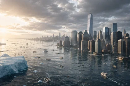
Climate change raises the background temperature in which weather occurs. A warmer atmosphere and ocean can influence extreme heat, heavy precipitation, drought conditions, wildfire risk, and tropical cyclone rainfall, although the strength of each connection differs by hazard and region.
Warmer air can hold more water vapor, creating conditions for heavier rainfall when storms develop. At the same time, higher temperatures increase evaporation, which can dry soils more rapidly and intensify drought in places where rainfall does not compensate for the additional moisture loss.
Ocean warming provides more energy and moisture for tropical cyclones. Climate change does not mean hurricanes suddenly occur everywhere, but warmer seas and higher sea levels can increase certain hurricane-related risks, particularly intense rainfall and storm-surge impacts.
No single unusual weather event should be explained simply by saying “climate change caused it.” Scientists increasingly use event attribution methods to estimate how human-driven warming changed the likelihood or intensity of specific extreme events compared with a cooler climate.
Why Natural Hazards Become Disasters
A natural hazard becomes a disaster when it seriously disrupts a community’s ability to function. The severity therefore depends not only on the physical event but also on how many people and assets are exposed and how vulnerable they are.
A strong earthquake beneath a sparsely populated desert may cause relatively little damage. A similar earthquake beneath a dense city with poorly reinforced buildings could produce catastrophic consequences.
Poverty, weak infrastructure, limited healthcare, inadequate warning systems, environmental degradation, and poorly planned development can all increase vulnerability. Communities with better building standards and emergency planning may experience much lower losses from similar hazards.
This is why disaster science increasingly considers risk as the interaction among hazard, exposure, vulnerability, and capacity to respond. Reducing disaster losses often means changing human systems rather than attempting to stop the natural process itself.
How Scientists Forecast Severe Weather
Modern weather forecasting begins with observations. Satellites measure clouds, temperatures, moisture, and atmospheric movement, while radar tracks precipitation and storms. Weather stations, ocean buoys, aircraft, and balloons provide additional information.
This enormous stream of data is fed into numerical weather prediction models. These computer programs use equations describing atmospheric physics to calculate how temperature, pressure, moisture, and wind may change over time.
Because the atmosphere is chaotic, tiny uncertainties in initial conditions can grow with time. Meteorologists therefore run multiple model simulations, known as ensembles, to estimate a range of possible outcomes rather than relying on one perfect forecast.
Human forecasters then interpret the models alongside observations and local knowledge. Forecast accuracy has improved enormously, but uncertainty remains unavoidable, especially for highly localized events such as thunderstorms, tornadoes, and flash floods.
How Satellites Help Track Natural Disasters
Weather satellites provide a continuous view of storms, clouds, wildfires, oceans, snow, ice, and atmospheric moisture. Geostationary satellites remain above the same region and can monitor developing weather almost continuously.
Polar-orbiting satellites travel around Earth and collect detailed measurements across the entire planet. Their instruments can measure temperature, humidity, sea-surface conditions, vegetation, smoke, and many other environmental properties.
During hurricanes, satellites help scientists estimate storm structure and monitor changes over remote oceans where surface observations are sparse. During wildfires, thermal sensors can identify heat and track smoke across enormous distances.
Satellites also support long-term disaster research. Comparing observations over years or decades helps scientists monitor drought, glacier retreat, land-use change, sea-level rise, and other processes that influence future hazards.
Can Natural Disasters Be Prevented?
Many natural processes cannot be stopped. Humans cannot prevent tectonic plates from moving, stop hurricanes from forming over warm oceans, or completely eliminate lightning and volcanic activity.
What societies can do is prevent hazards from becoming catastrophes. Stronger buildings, flood defenses, evacuation routes, wildfire-resistant construction, warning systems, and land-use planning can dramatically reduce injuries and deaths.
Forecasting also provides valuable time. A hurricane warning may allow several days for preparation, while tornado and flash-flood warnings can provide critical minutes. Volcano monitoring may offer indications of increased unrest before an eruption.
The goal of modern disaster management is therefore resilience. Communities prepare for hazards they cannot eliminate, reduce exposure where possible, and design systems that can withstand disruption and recover more quickly afterward.
Why Early Warning Systems Save Lives
An early warning system combines hazard detection, forecasting, communication, and public response. A warning only works if information reaches people quickly and they understand what action to take.
Tsunami warning networks use seismic instruments and ocean sensors to detect events capable of producing dangerous waves. Weather agencies use radar and satellites to warn of tornadoes, hurricanes, floods, and severe thunderstorms.
Technology alone is not enough. Communities need evacuation plans, accessible alerts, public education, transportation options, and clear messages that reach people regardless of language, disability, income, or location.
The most effective systems are therefore built around both science and human behavior. Knowing that danger is approaching has limited value unless communities can turn that knowledge into rapid protective action.
How People Can Prepare for Natural Disasters
Preparation begins with understanding which hazards are realistic where you live. Coastal communities may need hurricane or tsunami plans, while mountainous areas may face landslides, avalanches, or wildfire.
Households can prepare emergency supplies, important documents, medication, communication plans, and evacuation routes. Alerts from official weather and emergency agencies can provide critical information when conditions change rapidly.
Buildings and infrastructure also matter. Earthquake-resistant construction, elevated structures in flood zones, defensible space around homes in wildfire areas, and storm-safe rooms can reduce physical risk.
Preparation should not be driven by panic. Understanding the science behind hazards makes planning more practical because people can focus on realistic risks and evidence-based protective actions rather than rumors or sensational claims.
The Future of Weather and Disaster Science
Artificial intelligence, higher-resolution satellites, faster supercomputers, improved radar, and expanding sensor networks are giving scientists increasingly detailed information about Earth’s atmosphere and surface.
Machine-learning systems can help identify patterns in massive datasets, improve certain forecasting tasks, process satellite imagery, and assist with rapid damage assessments after disasters.
However, technology does not eliminate uncertainty. Weather remains chaotic, earthquakes cannot yet be predicted precisely, and human behavior strongly influences how warnings translate into real-world safety.
The future of disaster science will therefore combine better prediction with better preparation. Improvements in forecasting, climate modeling, infrastructure, communication, and public education can help societies reduce losses even as populations and climate conditions continue to change.
Understanding the Science Helps Us Prepare Better
The science behind weather and natural disasters reveals an interconnected planet. Solar energy drives atmospheric circulation, oceans exchange heat with the air, water moves through clouds and rivers, and tectonic plates continually reshape Earth’s crust.
Different disasters arise from different processes. Hurricanes and floods are mainly atmospheric and hydrological hazards, while earthquakes and volcanoes originate from geological forces. Wildfires, landslides, and droughts often emerge through interactions between weather, landscapes, ecosystems, and human activity.
Science cannot remove every threat, but it can dramatically improve our ability to recognize dangerous conditions. Forecasts, hazard maps, building codes, satellite monitoring, early warnings, and emergency planning are all practical applications of scientific understanding.
Ultimately, natural hazards become most dangerous when people are exposed without adequate protection. Understanding weather science, climate patterns, geological processes, disaster preparedness, and extreme weather gives communities a stronger foundation for making decisions before the next major event occurs.
Frequently Asked Questions
What causes most weather on Earth?
Weather is primarily driven by uneven heating from the Sun. Differences in temperature create pressure changes that move air, while water vapor, Earth’s rotation, and geography help produce clouds, rain, wind, and storms.
What is the difference between a natural hazard and a natural disaster?
A natural hazard is a potentially dangerous physical event such as an earthquake or hurricane. It becomes a disaster when it causes major harm to people, property, infrastructure, ecosystems, or society.
Can scientists predict natural disasters?
Scientists can forecast many weather hazards and estimate long-term earthquake or volcanic risks, but exact prediction varies by event. Hurricanes can often be tracked days ahead, while exact earthquake prediction remains impossible.
Does climate change cause natural disasters?
Climate change does not create geological hazards such as earthquakes, but it can influence weather-related extremes. Rising temperatures can affect heat waves, heavy rainfall, drought, wildfire conditions, and some tropical cyclone impacts.
Which natural disasters are hardest to predict?
Earthquakes remain especially difficult because scientists cannot reliably predict their exact timing, location, and magnitude beforehand. Tornadoes and flash floods can also develop rapidly, although modern monitoring can provide short-term warnings.